Geotrace is a geographical traceroute utility.. #Traceroute utility #Ping utility #Graphic route #Route #Trace #Utlity
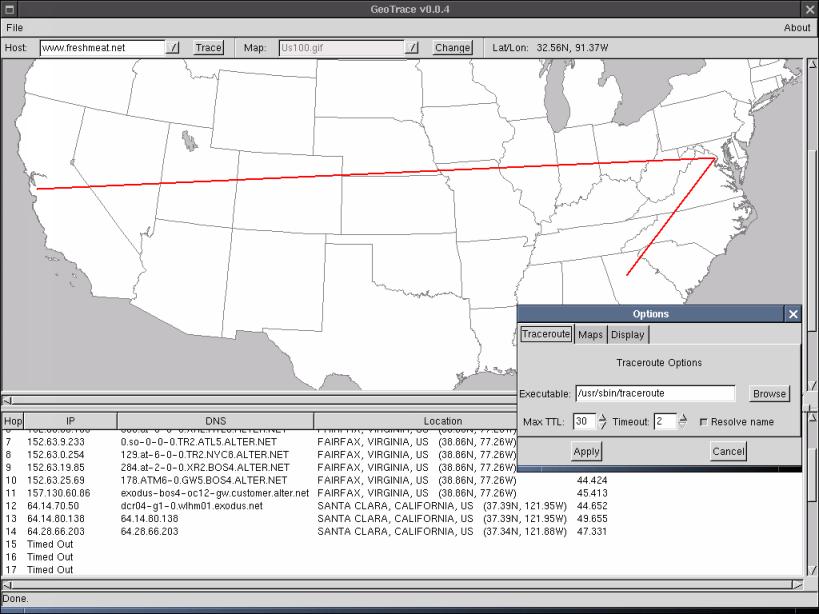
Geotrace is a geographical traceroute utility. Geotrace provide graphical view on the map. It has many geographical maps.
In order to be able to use a new map with geotrace, you only need to know one thing: the longitude/latitude of the top left and bottom right corners. Most maps you will find will be centered on 0,0 (about 5 degs south of Ghana and 10 degs west of Gabon. for those of you who don't know, it's in Africa.). Let's do it step by step: 1) Find a map. there are plenty on the web. Nasa's a good place to find them (it is a mess though). Or grab one of the few maps at a site with maps for XGlobe and XPlanet. The image must be in a format understood by gdk-pixbuf (most images you'll find will be jpeg or gif which work). 2) Go to the maps/ directory in geotrace. Put the map in there and open up maps.properties 3) on the second line, you'll see MAPS:World50.gif, World100.gif etc... That's a list of all the maps. Add the name of your recently downloaded map on that line. 4) now, you need to tell geotrace what the coordinates are. Add a line to the file that looks as follows: filename:BOUNDARY=lon1,lat1,lon2,lat2 filename: case sensitive, map has to be in the maps/ folder lon1 and lat1: longitude and latitude of the top left corner lon2 and lat2: longitude and latitude of the bottom right corner As I said earlier, for most maps you'll find, you'll get -180,90,180,-90 which means that the map is centered on 0,0. However, the two world maps (World100 and World50) in geotrace are centered on 10W,0 You might notice that the three maps of the US have another line associated with them. That's the alber projection. You probably won't have to deal with that. 4) Run geotrace, select your map from the drop-down and enjoy.
Limitations:
� Some hops may have extravagant locations, but for once, it's not my fault. The netgeo server does not have fully updated records. So my advice is, just live with it
What's New in This Release:
� added line color and width options. � added cmdline args. host to trace, and startup map. � added map options: path to maps and startup map. � warning to check paths when run for the first time. � added status bar � fixed draw_trace_on_map which didn't draw in certain cases (timeouts) � fixed bug that caused crash when a hop times out and more hops repond later � 2001-04-05 � added option: resolve host name or not � load/save options from file (~/.geotrace) 2001-04-04 � fixed bug that caused last map in file not to be read (world100) 2001-04-03 added options for traceroute (path to exec, timeout and maxttl)
Geotrace 0.0.4
add to watchlist add to download basket send us an update REPORT- runs on:
- Linux
- filename:
- geotrace-0.0.4.tar.gz
- main category:
- System
- developer:
- visit homepage
7-Zip 23.01 / 24.04 Beta

Bitdefender Antivirus Free 27.0.35.146

Zoom Client 6.0.0.37205

Microsoft Teams 24060.3102.2733.5911 Home / 1.7.00.7956 Work

paint.net 5.0.13 (5.13.8830.42291)

calibre 7.9.0

ShareX 16.0.1

Windows Sandbox Launcher 1.0.0

IrfanView 4.67

4k Video Downloader 1.5.3.0080 Plus / 4.30.0.5655

- Windows Sandbox Launcher
- IrfanView
- 4k Video Downloader
- 7-Zip
- Bitdefender Antivirus Free
- Zoom Client
- Microsoft Teams
- paint.net
- calibre
- ShareX